Monday, February 29, 2016

Canelo West

Passage Three: Mile 36.2 Canelo Pass Trailhead to Mile 53 at Patagonia, AZ

Day 6: I wake up happy and warm at the trailhead to Passage 3. Running low on H20, I head for that bright blue water I saw from above the day before. Hands loaded with my bladder and Nalgene, I find the small pond between the trailhead and the more well known but dry Flower Tank. It's a beautiful day and the water is a blissful blue, happy birds flap away when I approach and the surface is reflecting a mirrored image of the trees and sky. A little slice of heaven.


A get to the shore, and something is amiss. It smells awful. The shoreline is covered in cow patties. Flies buzz and weave and encircle me. The water is not blue, it's actually a filmy green and I swear it's the same ooze that Slimer from Ghostbusters is made from. The blue is the sky reflecting, which is the worst optical illusion ever. I stood there, weighing my options. Well, I guess I'll have to go chemical on this one, I thought as I bent down and put my Nalgene to the surface. I was scooping in some water and oh my god, I saw something revolting... a very large, very dead frog.


Repulsed, I stepped back. I can't drink this. To think, I thought Cement Water Trough was gross and I had absolutely no idea. I would drink that water in a heartbeat now. How far is it to the next water? I checked the map, 4 miles at Down Under Tank. How much good water to I have? Half a liter. Hm.

Alright, time for a plan. I'll grab one Nalgene full of the dead frog Slimer water, get the chemical tablets started now and in addition, I'll filter it before I consume it but I really hope I don't have to drink it. Better to have than have not when it comes to water.

I scoop up the stinky slime. My clear Nalgene turns green in color. I leave that foul place, add the chemical tablets, pack up my bag and head for the hills. 


4 miles to go: I drink .25L so there's  .25L left of good water. The trail goes up an incline and I'm chugging along and the sun gets higher and higher in the sky. I'm getting thirsty, but I've been thirstier. If I just make this hill, I'll be alright.


3 miles to go: I suck the last .25L out of the filter. There's not much pressure, so I have to lift the bladder over my head and suck a mixture of air bubbles and water droplets out of the hose...slap the wine bag, Tour d'Franzia style. Thirsty, but I will not drink the frog water. I've reached the top, and it's all downhill now.


2 miles to go: My mouth is dry. Why am I sweating so much? I need to keep in that water! I'm really thirsty. I really don't want to drink the frog water, but I'm going to have to soon. I'm going downhill now, which means I'll have to go back up.

Then, I see a large pool of water as I cross from one dirt road to the next. Is it a mirage in the desert? There's blue, a stark contrast to the sea of prairie-like golden grassland, glistening for me in the sun. That must be it. That's not that far, I can make that. The sight of the blue quenched my thirst and I had the strength to keep on trekking. 

The road wound nearer and nearer to the blue, and then abruptly took a sharp right turn. Noooooo, that's away from the pond! 

What's a gal to do now? I'm so thirsty. Do I go for what I see with my own eyes that looks about 2 miles away or go for what the map tells me which is also two miles away?

I decide for some weird reason, that I was going to trust the trail. What if it was a mirage? I'm sure it wasn't, but just in case, I'm not about to be lured by some phony water. I won't be fooled by illusions twice in one day. Then, I'd be worse off and four miles from the known water source. Trust the trail. You have the frog water if you can't make it.


1 mile to go: So thirsty, it is hard to think. It feels like the sun is shooting rays directly at me. I'm melting into the mud. It's time, Kara. You're going to have to drink the frog water. It's going to be okay. You have purification tablets and a filter. It's better to drink bad water than none at all.

I look at the map. 1 mile. I can handle that. I can do anything for a mile. I plod along, with each step getting closer, but seemingly not close enough. Slower and slower until I finally reach what looks like a little streambed. I follow it along until it leads to Down Under Tank. I've made it.

There's a mess of cows around, relaxing and munching on grass but if I've learned anything this week, it's that looks can be deceiving. Bathtub Spring looked a little gross but had clear water, the blue pool looked beautiful from afar but was disgusting. Surely cow water is better than dead frog Slimer water?


There's a little green algae on the edge, but this pond is big and deep enough that if I go the steep sided embankment and fill'er up that it should be fine. I happily pour out the frog water and dip my Nalgene in. Crystal clear. I drink through the filter voraciously. Ah I instantly feel like a million bucks. Any day you don't have to drink frog water is a good day. I sit in the shade eating a snack, sipping frequently to regain total hydration and playfully moo at the cows. 


Feeling refreshed, I looked at the map and the time and thought I should try for Patagonia, mile 53. It's a stretch but I could make up for some lost time yesterday and truly have a zero day tomorrow.

I sped on. I hiked through Cott Tank Enclosure which is a cool riparian rehab zone and out to Red Bank Well. Red Bank has a windmill and a large metal tank just shooting out water which is super convenient. 


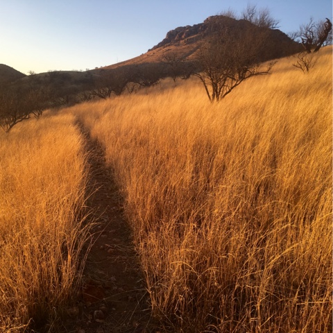
From there, it was through Red Rock Canyon (which frankly, isn't as impressive as other famous red rock sites in the US) and a lot a lot a lot cattle grazing land. The rest of passage, with its tall grass reminds me more of my home near the prairie than any place I pictured in Arizona. 

I kept chugging along as it got darker and darker. I was thinking of calling it a quits but as I crested the last big hill and saw the lights of Patagonia, I couldn't help pushing through. I did the last 2 miles on the trail with a headlamp and got to Harshaw Road around 7:30. From there, it was 3 road miles to town. I'm kind of glad I came in late because road mile are never as interesting as being on the trail itself. 


After hiking a total of 17 miles, I made to town and got a room at the Stage Stop Inn, a lovely establishment. I took one of the most worthwhile showers of my life and looked in the mirror, it looks like someone beat the crap out me. 

Tired eyes, rough looking feet, mysterious gashes in my legs...I've got scrapes on my shoulders from backpack straps and cuts on my arms from mesquite thorns. I'm only 53 miles in, but I feel like I'm starting to change. I'm a shade tanner, a dash thinner, and a bit tougher than I was before. What will I look like in another 50 miles? In 100? In 750? I guess we'll have to find out. But first, I'm going to eat an entire El Sassy pizza from the Velvet Elvis. (To be continued...)

Sunday, February 28, 2016

Canelo East

Passage Two: Mile 21.7 Parker Canyon Lake Trailhead to Mile 36.2 Canelo Pass Trailhead 

Day 4, continued: Cough. It's hot. The sun is unforgiving and it makes me dream of being cold again like up on the mountain. I'm impressed by such extremes in such a short time span.

I pass by the lake, appreciating its novelty in a place where water can be hard to come by. I could go down for a swim, but I'm not in the mood for a detour anymore. The goal now is to make it to a nearby river for a snack and to fill up on H20 and relax in the shade.


Sneak attack by another cow hiding in the trees. I keep getting totally surprised by them because they pop up in the weirdest places. The large, sneaky animals I'm used to being surprised by are grizzlies so for some reason, I feel like I have to give them space and talk to them. Cows don't care, they just chew their cud and look at you with those big dumb eyes.


Around 2pm, I see from a distance what appears to be a cowboy with a glorious mustache on horseback. The horsemen - sporting the traditional 10-gallon hat - approached. "Howdy!" I say. With that, the black stallion bucked and the mustached cowboy tried to regain control. I seriously never thought little old me could spook a horse. He pulled the reigns and tried to manueaver the horse nearer but the horse remained timid and very cautious of me, giving me quite the stink eye. "I didn't mean to spook your horse."

"Ah, you'd think she never saw a person before." 

"Are you looking for a cow? I just ran into one down the trail."

"No, she's not afraid of cows."

-I think he misheard me. After closer inspection, I see the man with the Ron Swanson 'stache had a patch on his arm that says "U.S. BORDER PATROL" in big dark print. 

"Where ya headed?" He questioned half yelling as his horse started to back away.

"Patagonia."

"Not all the way today, right?"

"No, probably two days."

The horse was really moving past me now. "Okay, have a good one." 

That was it. I guess I do look pretty blonde and Polish. I am a little concerned about his horse...if it is afraid of me - an average hiker - what good will it be when there's an old timey Western chase scene when the officer finds migrants? Oh wait, that doesn't happen. That's all in my imagination. 

Down to the river at mile 24.2, I fill up and enjoy the shade. There's a gentle breeze and it smells good down there. It smells rich like grass, like trees, like life.


Hike hike hike on up and down rolling hills that are truly pleasant compared to the drastic lung busting inclines and knee crushing declines of the mountains. I'm still not feeling 100% but I'm enjoying the day after all. I'm glad I kept going. 


I keep walking until the sun starts to set and I'm on a saddle at 6063' - a good stopping point. I set up camp and enjoy the sunset as I eat a Mountain House, plan tomorrow's hike and snuggle into my sleeping bag. The night is calm. The weather is warm. I look out to Miller Peak and it feels so far away from me now. The terrain is so different here. It is not necessarily as drastic as the mountains when it comes to topography, but certainly in beauty. Coyotes are yelping and hollering in distant locales. I imagine they're have a laugh around a campfire, telling funny stories. I feel grand. 


Day 5: I wake up and start the day with two packets of oatmeal and some coffee. I send my Mom "Everything is OK" message on my Delorme Explorer. I turn it off and finish my coffee, sitting halfway in the tent and halfway out. I notice today that despite all the baby wipe backpacker showers and river bathing...I really stink. I stink a stank I never stunk. 

I see and hear from down the valley a black helicopter fluttering around towards the Parker Canyon River. Hm. It must be Border Patrol. I watch as the helicopter approaches up the valley and right above me. I get out of the tent, stand up and give it a look over. Not BP, Cochise County Sheriff. They see me and circle around. I give them a thumbs up and  starting getting dressed and packing up. Today, I think I'll wear the pink wool hiking shirt, since it's less rank. A pink so pank it's punk. I think about the helicopter's behavior and how I'm in Santa Cruz County, I know, because I was very proud to have walked out of the Cochise yesterday. 

The chopper leaves and returns and continues to circle me. I'm confused. Had I accidentally sent an SOS  when I messaged my Mom? Oh god I hope not! Nah, I work for the government, things would never happen that fast. I keep giving the thumbs up and make an X with my arms like you're supposed to signal to aircraft. They go away for awhile and I finish my packing in peace. They must be running maneuvers or practicing...

Down off the saddle, I get in my hiking rhythm. I hear the 'copter come back, this time really close. Hovering real low, I could feel the wind from the blades. Now, I'm getting angry. It's loud and I plug my ears. They leave.


I hike for two miles to Forest Road 4749, where I hear people's voices. They're shouting out a name. Out of respect for the individual, I'm changing her name to...Mary. 

"You're not Mary" annouced a tall, middle aged man in a black t-shirt, cargo pants and a wide brimmed hat. His name is Scott.

"No, I am not." 

"We're looking for a lost hiker." 

I think, oooooh everything makes a lot more sense now. 

"Did you get chased down by a helicopter? They said the hiker kept giving them a thumbs up and continued hiking so it didn't make sense that it would be Mary, but we thought we'd meet up with you and see if you saw anybody."

"Nope. I haven't seen anyone since 2pm yesterday when encountered BP on horseback."

"Well, we'll tell them that you are definitely not Mary and you can hike in peace."

"Well, I have this satellite messenger, if you give your number and a description of her, I can message you if I find her." 

"Okay, great. 74 year old female, 5'2" short, wiry red hair." 

I gather some other information like place last seen, when they realized she was overdue, etc...all the things they've taught me about in park ranger trainings throughout the years... It turns out that I would be unlikely to encounter her because she was supposed to be back by Parker Lake, and I'm quite a distance from there now. 

Two middle aged women join up with us, friends of Mary. I mention how sorry I am that I'm not their friend, but I'll keep a look out. We say our goodbyes and they give me a KIND bar, which I do really kind of love.

I hike on, down through Pauline Canyon which is forested and cool. I take a break, wolf down the KIND bar and sip my water. I'm getting low, but there's supposed to be some aqua in Middle Canyon, just about a mile away so I'm not worried. Up a hill and down across another dirt road. I'm headed back up a hill when I see a backpack. Next to it, a hat, and then, I see a person...a woman person! She too is wearing a bright pink shirt and lying in the shade, but she's not moving. Oh no, I found Mary and she's dead, I think to myself.  

"Hello?"

The woman stirs. Whew, sheeeeeee's alive!

"Hi."

Smiling, I ask, "Are you Mary?"

"Yes."

"Oh, am I so glad I found you!"

She tells me about she was hiking and how she got turned around. She knows she should learn how to use a GPS, but was resistant until now. She decided to stay put in the shade and wait for someone to come. (The right thing to do.) I ask if she needed water and she says that's the only thing she needs. I give her the rest of mine, knowing that less than 1/2 mile more is to be had. 

"I'm not lost. I'm navigationally challenged." she jokes. I laugh nervously like a ranger would do in the knowledge that she had no detailed map, no compass, and didn't know there's water nearby...

I start getting on the Explorer to contact people and tell her she's alright. The decision came that I would walk out with her to Canelo Pass, about 4 miles where someone could pick her up. 

We stop in Middle Canyon for water. She has a filter but doesn't know how to use it. I show her. She's using a Dasani plastic water bottle and the ranger in me cringes at having so little water. I'm a beast. I drink a lot of water and hate being even slightly dehydrated. I don't care how much it weighs, I rather have enough than too little. I fill up both my 3L bladder and 1.5L Nalgene - though it's only four miles to the next water - in the off (or likely) chance that she'll want more than that itsy Dasani bottle.


We hike. It's slow going but we're doing fine. I'm quite impressed by her 74 year old stamina as we hike to the high point. I feel bad for being inwardly grumpy about water even though I never showed my frustration. She's an outdoorswoman who just lost her way, and who hasn't in life, really? That being said, the desert is no joke. Mary ended up drinking a good portion of my extra water.

We get to the high point where the Scott from earlier meets us. He takes her pack and we three all hike down to Canelo Pass together. At the road, Mary thanks me and Scott puts some beer in plastic water bottles as a thank you. The Wisconsinite in me is happy. They depart and I decide to set up camp right there. I saw as we were descending the hill, there's a bright blue tank (note: "tanks" are a term for water ponds) not far from here so I can fill up before heading out.

I prepared dinner and thought about how uneventful the search and rescue was. I definitely am glad of it. Things went really well in Mary's favor and I'm happy that I stumbled upon her. The Canelo Hills are not as rugged at the Huachucas, but they certainly are remote. Who knows when the next person would be hiking in that area this time of year? 

I read the ingredient list to my dehydrated  chicken and rice Mountain House and on the packaging there's a Yogi Berra quote, "If you don't know where you're going, you might end up someplace else." After the day's events, I took a sip of beer and couldn't help but chuckle. 

(To be continued...)

Saturday, February 27, 2016

Huachuca

Passage One: Mile 0 US-Mexican Border to Mile 21.7 Parker Canyon Lake Trailhead

Day 1: My trip into the mountains started like many trips do, with a fond farewell. I had been visiting with friends Andy and Ali in the greater Californa-Nevada-Arizona area for about a month, camping and hiking and exploring. They so kindly said they'd drive me down to the border to start this crazy trek along the Arizona National Scenic Trail (AZT) and they did just that on Monday. What swell people and first trail angels they truly are!

Hugs and goodbyes finished and fully loaded with gear, food, water and hope, I made way up the Joe's Canyon Trail from the Coronado National Memorial Visitor Center. This trail is nearly 5 strenuous miles up to Yaqui Ridge and back down to the border. It's a haul for sure, but I happily hoofed towards the border still filled with anticipation and those awesome pre-hike jitters.


As I rounded the final corner of the trail before the border monument - which is the true start of the AZT - high velocity wind gusts came cruising around a bend in the topography and rather unpleasantly blew sand directly in my face. This made it difficult to joyfully commemorate this momentous beginning and hastened me along the trail. Little did I know that this breeze was just foreshadowing for my entire trip in the Huachucas.


Up up up and back to Yaqui Ridge and finally to Montezuma Pass, where many begin their hike to the monument. It was really getting windy up there, but one must press on. I used the pit toilets one last time and waved to the Border Patrol officer. Crossing the road, the trail follows the "Crest Trail," which winds up past old mine adits and along some stellar ridges. I met two Canadians on their way down, and they were the last people I'd see for two days.


I had gotten a late-ish start. The sun was getting low, my shadow was getting long, and the trail was getting steeper so I had to think about where to camp soon. There's no camping in Coronado National Memorial on account of the border activity, so I had to get to the boundary with the Miller Peak Wilderness in Coronado National Forest, which is only 2 miles from Montezuma Pass.

A rough two miles, steep with heavy pack and the wind now blowing 35 mph, it was slow going. On a knife ridge, a tremendous gust popped my hat up and with it my sunglasses flew into the air and down the canyon. I could see them tumble, hitting rock and after rock after rock. It was way too windy and steep to retrieve them, lest I wanted to end up where they are...so my sunglasses are now forever sacrificed to the Huachuca Mountains. Woof. I put my head down like a sled dog and just grumbled my way to the top. If it weren't so windy, I would have soaked up the scenery more.


I made it to the wilderness boundary with a little light creaking from the mountains. I've never been so happy to see a sign and a flat place to camp. 


The wind was howling and the trees were  bashing and rubbing against each other, but I was in a little alcove that I thought wasn't too terrible. I tried setting up my tent but every time I got the stakes down and lifted one of the trekking poles, a gust would come tearing through and turn my tent into a parachute. 

After several tries, I gave up and decided I'd just have to set down my sleeping bag and pad and wrap myself in the tent like an emergency bivvy or hypo wrap one learns about in WFR. It worked pretty well at keeping the wind out and me from being too chilly. There were cracks, which every now and then I would get a cold shot of air on my back or face, just enough to keep me from sleeping. 

I laid there, tired after hiking 8 miles, looking at both the stars in the sky and the lights of Mexico with mixed feelings. I've made mistake. This hike isn't going to be fun and it's just not worth it. No, this hike will be challenging, and that's so worth it. I literally could have gone either way. 

Day 2: Many sleepless hours pass, the wind becomes more of a breeze and the sun begins to rise. I slowly get gumption  and begin to get the F out of there. 

Not far down the trail I find a perfect snow patch in the sun and use it to get some fresh water and eat breakfast. I listened to some Hank Williams on my phone - because it just felt right - while I scraped the top layer of ice off with my trowel and got down to the good stuff in the middle. Trowels really are so useful. Snow extractor, cathole digger, impromptu tent stake...I love you, trowel. 


Feeling better after Hank, grub, and sun, I begin the long journey up the steep rocky trail through fire scars to nearly the top of Miller Peak. Oh my god, did I mention steep? I will have amazing legs after this. 


9000something' and that breeze below now whips up and kicks you right in the face. Alas, the worst is behind and it's time to descend. I've been looking forward to this because I'm sick of the up and sick of the wind.


Not far from the Miller Peak turnout, the trail goes into the shady leeward side of the mountain. And so, the trail is easy to follow because you step in someone's ankle-high footholes in the snow. In some places, trees have fallen across the trail (presumably the night before) and new little routes would have to be made, causing adventures in waist-deep post holing. 


The snow continued for awhile, until about AZT mile 8.3 where a bizarre but welcomed sight awaits the weary traveler... A seemingly algae filled bathtub, trickling out spring water, cold and clear! Why yes, I spent some time there and filled up my various vessels.


Onward and upward as the 6 o'clock hour approaches. Soon, I find my way to a nice flat and breeze-free campsite on Bear Saddle at 8100'. Not far from a spring if need be, though I had just filled up. All's well as I set up camp and eat dinner as the sun sets. The sunset was so peaceful after a hard day sweating and trudging up and down...the soothing blues, pastel pinks and faint yellows put me to ease as they let way for stars and more far off city lights and I drifted to sleep. 


Darkness. I'm abruptly awoken by pummeling winds announcing themselves from distant canyons and roaring into the sides of my tent. The walls collapsing around me and I was cold. So cold. I grew up in Wisconsin. I live in Alaska. I've never been this cold. Shivering for warmth in my 0 Degree Never Summer down chrysalis. Fade into sleep. Fade out. Fade in. I awake several times throughout the night to thundering wind. 

Day 3: Morning, fade out. Cold. Crunchy. Why am I so crunchy? Frost. Why does my throat hurt? Dry cough. Thirsty. Water's frozen.

I wait for the sun to shine in on me before I escape the sleeping bag or tent. I thaw out and slowly get moving, warming water and making breakfast. Cough. I think I'm sick. 

Packed and ready to once again get the F outta there, I head up the hill. One last up before the long downward zigzag to Sunnyside Canyon. Hard to breathe. 

Down down down down. Will I have knees after this? So worth it. Warmer already as I make it to Copper Glance trailhead at 7194' and feeling almost good when I get to mile 16 for water. This stop, the cement water trough, is known to be a fairly reliable source. Now, I wasn't expecting much as cows outnumber people in these parts, but frankly, yuck. Stagnant and scuzzy, this trough is not for me. There's a perfectly good stream right next to it, so that's where I scooped in my H2O.


Following Scotia Canyon, I walked out of the wilderness and past a few windmills, spooking cows and vise versa along the way. 


The sun crept slowly down as I made it to mile 20. I camped in some grass and the night was wind-free, clear, and cool.


Day 4: Drip. Drip drip. Drop. I had dreams about caving. I woke up crunchy again but my tent ceiling was dripping water onto my face. Melting frost in the morning sun. My throat still hurt but life  was not nearly as miserable as the night before, so I was thankful. Funny how it takes being cold and miserable to truly appreciate the many comforts one is afforded in life... 

Not feeling very well or motivated at all, I waited until noon for the tent to dry out and get back on the trail. I was going to finish the passage that day I decided because it's only 1.7 miles, but I'm not sure how much more I could do after that. Maybe I could just camp at Parker Canyon Lake (not far from the passage terminus) until I feel better? That could be nice since I can't really breathe and it's sunny and there's plenty of water.


I weave through savanna like shrub and grasslands and finally get to the Parker Canyon Lake Trailhead. Woot! I made through and the sun is shining. There's a bit of trail behind me and a beautiful lake ahead of me. Maybe things are looking up after all.


Maybe, I can go on. (To be continued...)